In order to improve community preparedness for tsunami and guiding emergency management agencies and communities on proper response, information on evacuation procedures and shelters are essential.
The 2004 Indian Ocean tsunami highlighted the need to raise awareness about the hazard and its risks to lives and livelihoods, as well as the need for preparedness for a similar event. Hazard and risk assessments identify areas that are exposed to the tsunami, quantify their risk to the hazard, and are used as a basis in preparedness planning. Evacuation zones can be established at local level based on results from hazard analysis and risk assessment. Consequently, detailed tsunami evacuation maps, showing tsunami safe areas and escape routes can be generated.
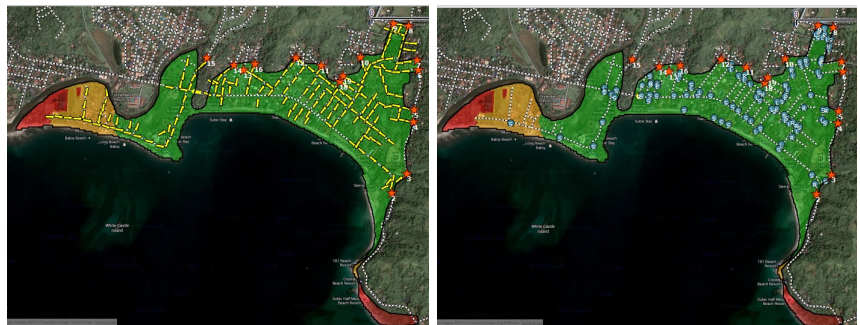
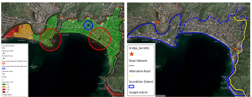
ESCAPE maps the shortest and fastest evacuation route toward safe shelters, with due consideration of topographic condition, land use, location of critical facilities, population density, age and gender. The system can provide information and guide on the fastest path and evacuation direction toward shelters. Evacuation basins can be determined to partition the area to several zones, which designated shelters can accommodate.
ESCAPE components and functionality
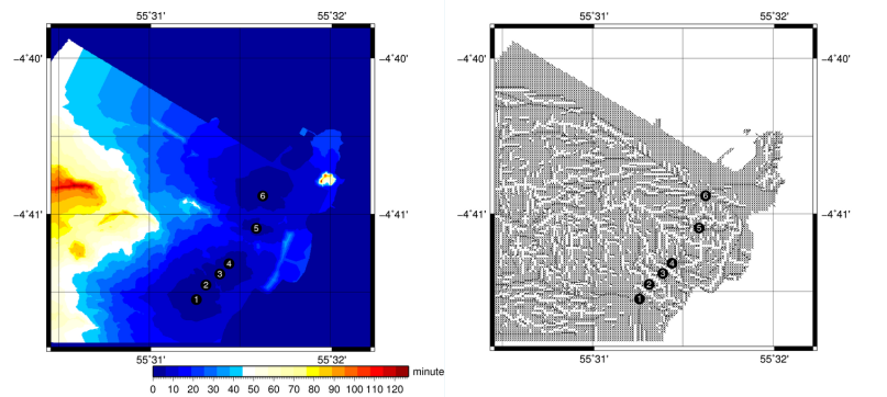
Evacuation surface modeling employs a cost-weighted distance approach in generating optimum evacuation routes from any point within the inundation zone to the nearest shelters.
Speed factors corresponding to the following parameters can be specified by the user according to local conditions. Factors considered in evaluating evacuation speed include i) land use ii) topographic slope, iii) age and gender iv) population density v) access to critical facilities
Simulation outputs which can be integrated for further analysis include:
- evacuation basin, which defines the evacuation zones with designated shelters
- evacuation time, which is the required time for evacuation from any point within the inundation zone to the designated shelter
- evacuation direction, which provides optimum direction for movement at any point within the inundation zone.
Route simulation component is designed for searching the fastest path from any selected starting point towards the designated shelter.
Shelter capacity component evaluates shelter capacity against expected number of evacuees.
Evacuation mapping allows users to incorporate worst case scenario in consultation with local authorities and based on historical events or previous studies.