Localized and user-tailored ocean information is critical for effective management of maritime activities, such as shipping, maritime recreations, fisheries, and disaster preparedness in islands and coastal regions. Most RIMES Member States in the Indian Ocean have access only to forecasts at coarse resolutions (global and regional scales), which are hardly interpreted by the user agencies for decision making in the countries.
RIMES in collaboration with the Indian National Centre for Ocean Information Services (INCOIS), is strengthening capacities of the coastal countries in the region to provide operational customized ocean forecasts through Ocean State Forecasting and Advisory System (OSFAS).
OSFAS components and functionality
Customization of oceanic/marine forecast information
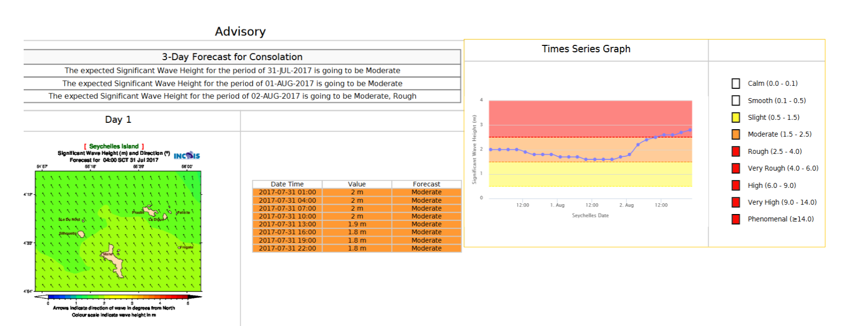
Existing data and updated local bathymetric data are integrated by INCOIS into its forecasting system to generate desired products for a range of users – locally and regionally – in each country. These products include 3-day forecasts of wave and swell height, direction, and period, sea surface current and temperature, and wind speed from INCOIS’ Indian Ocean Forecast System (INDOFOS).
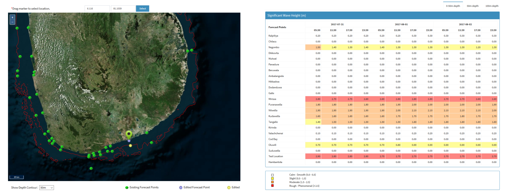
OSFAS offers flexibility and agency to the users to customize forecast extent and define location as well as receive user feedback for validating forecast information. In addition, the system has capability to track wave rider buoy location and has an alert messaging service in case of buoy drift.
Additionally, the system can provide information from INCOIS’ Marine Fishery Advisory (derived from satellite images and Potential Fishing Zone (PFZ) advisories) and Coral Reef Mapping and Reef Health Monitoring (derived from satellite images and Coral Bleaching Alert System).
Advisory generation system
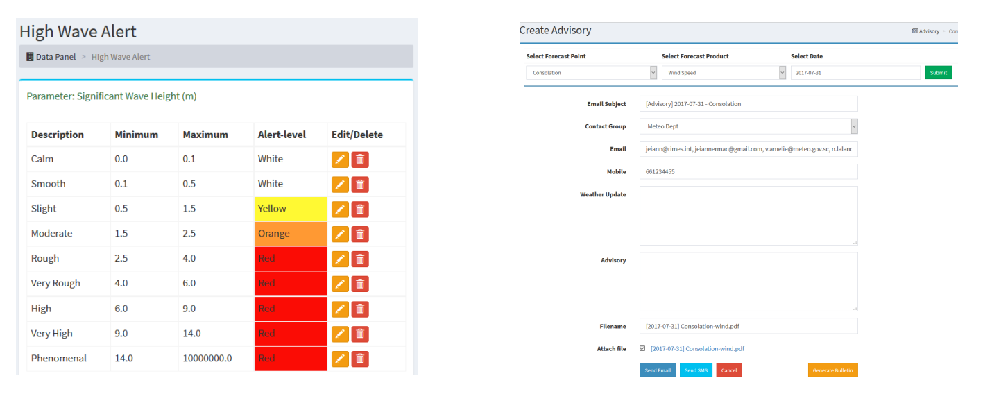
Forecast parameters are categorized according to known standard scales, e.g. Beaufort scale for wind speed, and Douglas scale for wave heights. Alert levels and categories may be defined by the user, for providing advisories. Advisory bulletins may be generated and disseminated via email and/or SMS.
WRF products
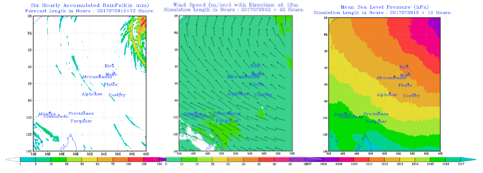
The system includes forecast data on rainfall, temperature, wind, and MSL pressure. Short-term weather information, with 3-5 days lead time, is generated on a daily basis to monitor extreme weather events in the region.
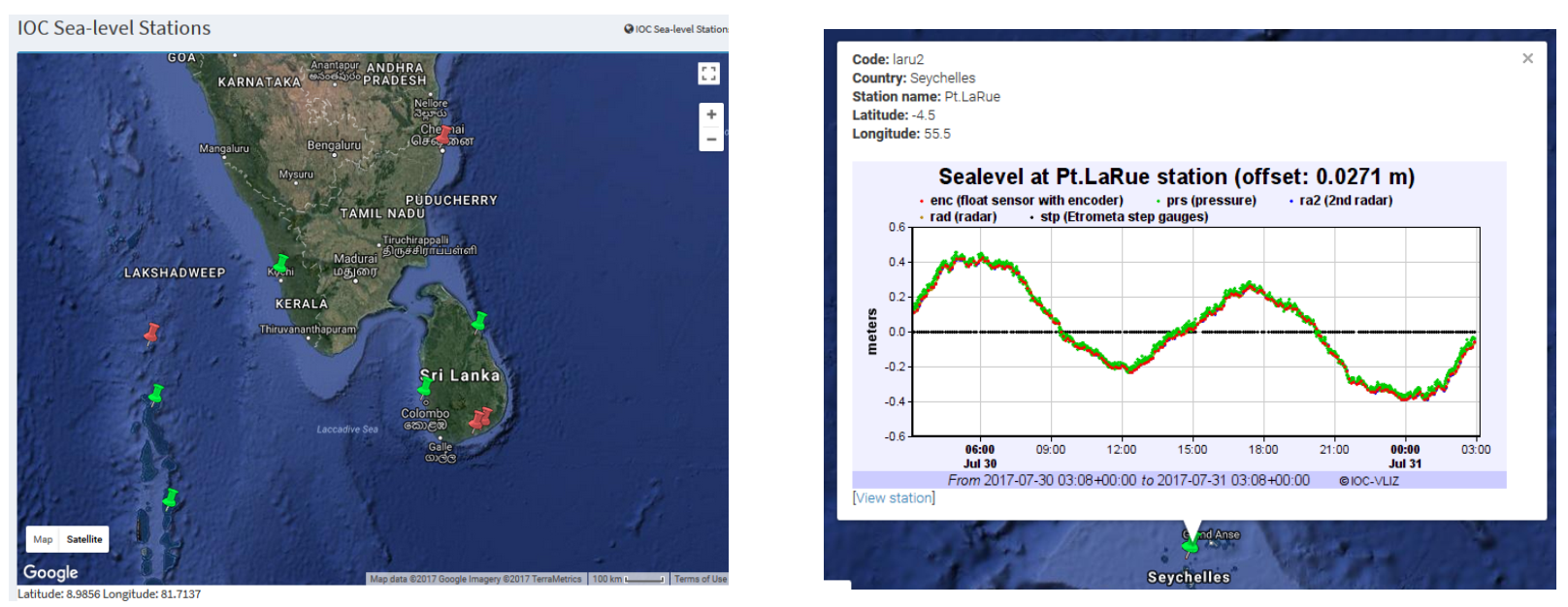
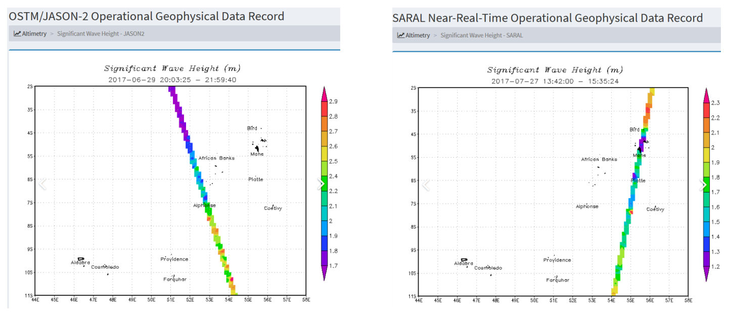
Real-/near-real time observation data
Real-time sea level data (IOC) and near-real time satellite data are provided as additional sources of information for forecast verification, calibration, and trend analysis.