FROM TRAGEDY TO RESILIENCE:
How the 2004 Tsunami Transformed Disaster Preparedness in the Region
Achievements and challenges in building a safer world
The catastrophic 2004 Indian Ocean Tsunami permanently altered our approach to disaster risk management. It laid bare the urgent necessity for strong, coordinated, transboundary multi-hazard early warning systems that delivers early warning information to unreached, at-risk communities.
The tsunami served as a wake-up call that sprang the region into action, setting the foundation for the establishment of the Regional Integrated Multi-Hazard Early Warning System for Africa and Asia (RIMES) in 2009 through the UNESCAP Trust Fund For Tsunami, Disaster And Climate Preparedness. Twenty years after the 2004 Indian Ocean Tsunami, RIMES continues to assist countries in protecting communities across the Indian Ocean while reflecting on the progress made and the challenges that lie ahead.

RIMES-in-action through the years
The 2004 tragedy underscored the power of cooperation beyond the borders. Across Africa, Asia, and the Pacific, RIMES has developed a robust network of partners, including communities, governments, and scientific institutions. Together, we have created a robust framework for information exchange that empowers countries and communities.
Evolution of Early Warning Systems
Twenty years ago, early warning systems had limited scope. Over the years, risk assessments, forecasting, and dissemination has been revolutionized by utilizing technological breakthroughs. We are now able to deliver quicker and more actionable warnings for tsunamis and many other hazards, including floods and cyclones, through the advancements in satellite and ground-based sensors, predictive analytics driven by artificial intelligence.
RIMES has co-developed a number of user-centric decision support tools in collaboration with our stakeholders to assess and respond to impending risk of tsunamis including:
- INSPIRE (Internet-based Simulation Platform for Inundation and Risk Evaluation): A web portal that empowers users to identify tsunami sources, simulate inundation scenarios, and assess risks. It incorporates multi-dimensional vulnerability data and can handle varying levels of data accuracy, making it adaptable to the data available in different regions.
Taken from the INSPIRE DSS: inundation height, probability of building damage for Kamala Beach, Thailand
- ESCAPE (Evaluation System for Computing Accessibility and Planning Evacuation): A system that supports evacuation planning by identifying the fastest evacuation routes in high-risk areas. It considers topography, land use, critical facility locations, population density, age, and gender to provide optimized evacuation routes toward designated shelters. ESCAPE can partition areas into zones that each designated shelter can serve, with shelter capacities evaluated based on population data, enhancing community safety during emergencies.
Taken from the ESCAPE DSS: simplified evacuation routes and direction guides (left) and evacuation signage and location (right) for Barrio Barreto, Philippines
-
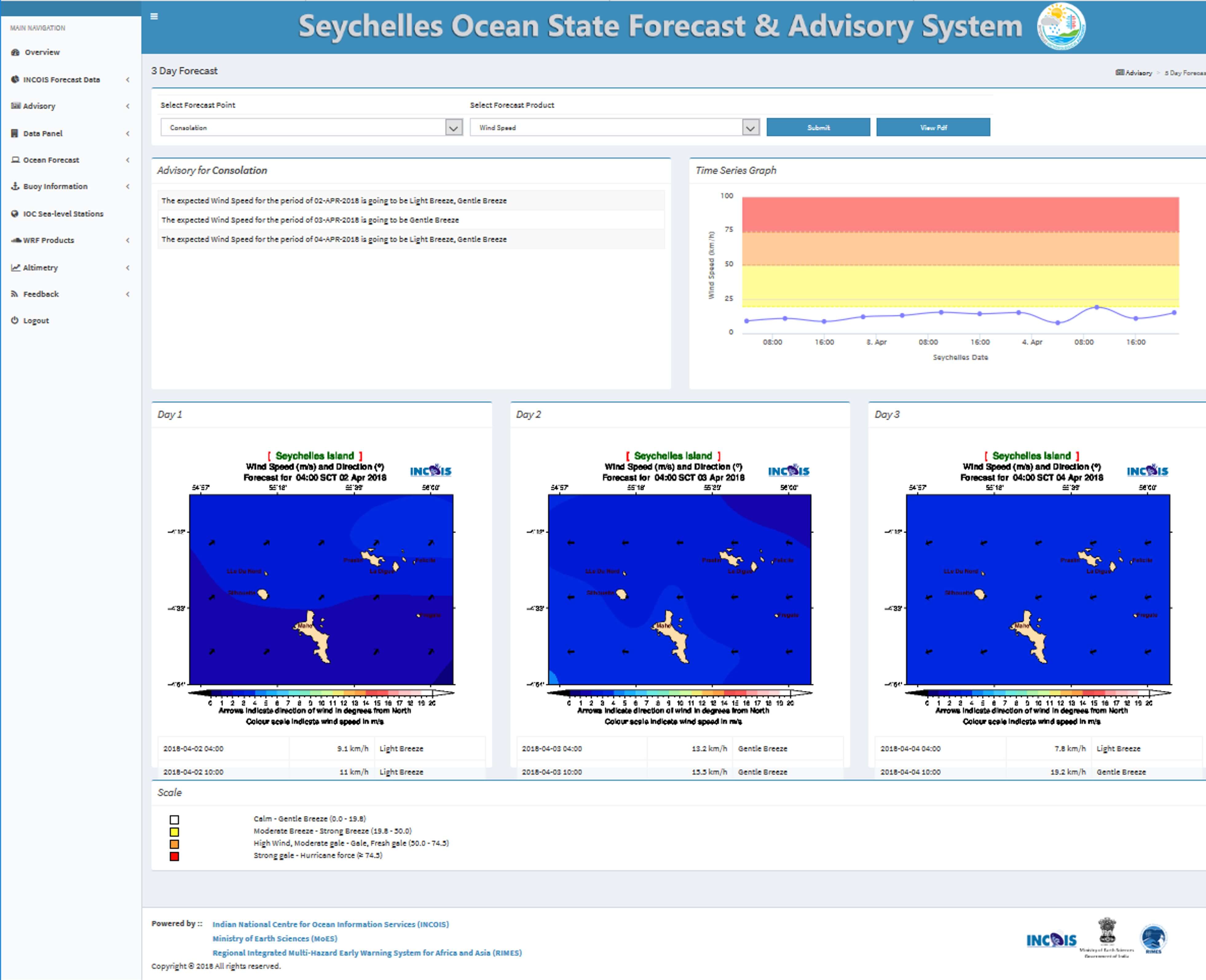
OSFAS (Ocean State Forecasting and Advisory System): This web-based tool provides real-time or near-real-time marine condition forecasts, tailored to local needs. It can translate complex ocean forecast data into user-friendly information and disseminates marine advisories, including 3-day forecasts, via email. It also includes a feedback system that allows users to validate forecast accuracy, improving both the tool’s reliability and user trust.

OSFAS DSS Interface for Seychelles
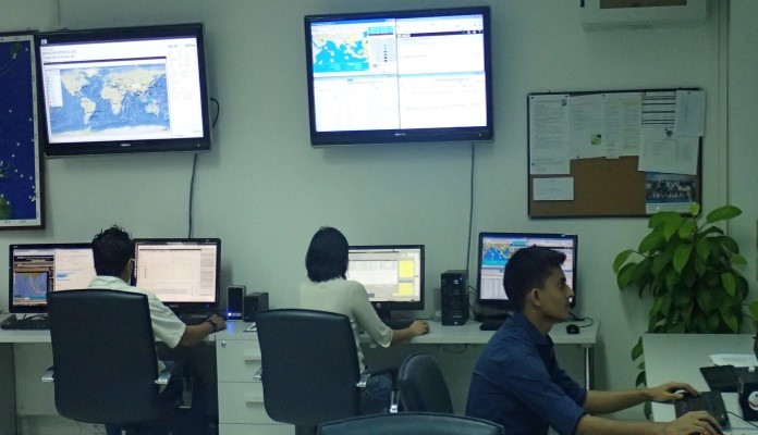
At the core of RIMES’ operations is the Tsunami Watch Center, which monitors seismic activity and sea levels 24/7, providing essential real-time data to national agencies within the framework of the Intergovernmental Oceanographic Commission of UNESCO (IOC-UNESCO). By complementing the services of regional tsunami providers, RIMES ensures that early warning information is clear, actionable, and readily accessible to communities most at risk.

Tsunami Watch Center in RIMES Headquarters in Thailand
Today, RIMES operates under a robust multi-hazard approach that acknowledges the interconnectedness of natural hazards and climate variability. This shift has equipped communities to respond not only to tsunamis but also to cascading risks that compound the impacts of other disasters. Our systems now go beyond detection—they integrate risk assessments that enable organizations and communities to anticipate potential impact and take ex-ante actions.
Building Community Resilience
The memory of the 2004 tsunami highlighted a key feature: preparedness begins at the community level. Despite the advancements in science and technology for early warnings, these efforts are only effective if it is communicated in probabilistic terms, with explicit reflection of uncertainties associated with hazard advisories to people on the ground, to enable them to appreciate risks, understand, trust, and respond to the information they receive. Thus, RIMES continued to commit its efforts in community-based programs and educational initiatives over the past two decades, promoting everything from early action protocols, tsunami drills, and evacuation planning to overall disaster literacy.
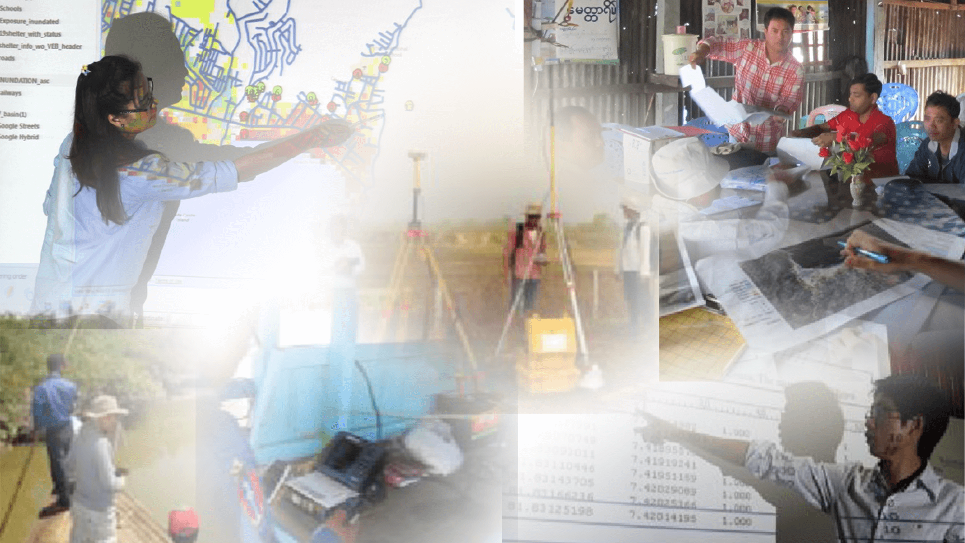
RIMES working hand-in-hand with partners and communities to promote disaster preparedness and resilience.
One key initiative, Strengthening Last Mile Communication in the South Asia Region, funded by the United States Agency for International Development (USAID) through the University Corporation for Atmospheric Research (UCAR), focuses on building community resilience by enhancing access to and use of early warning information among vulnerable communities. This program promotes an end-to-end, people-centered multi-hazard warning system that strengthens early warning mechanisms and anticipatory actions at the community level, ensuring critical information reaches those who need it most.
Empowering local communities to act upon early warnings has become a cornerstone of RIMES’s approach. By collaborating with national and local governments and NGOs, RIMES has been working to ensure access to multi-hazard early warning information and substantially reduce the vulnerability of coastal populations. RIMES remains committed to empowering communities with the knowledge and resources needed to protect themselves, ensuring that the lessons of 2004 continue to guide our approach to disaster preparedness and response.
Challenges Ahead
Despite the progress made in the past two decades, numerous challenges remain to be addressed. Significant differences in institutional capabilities, financial resources, and technical access continue to impede equitable access to early warnings throughout the region. Additionally, as digital misinformation proliferates, RIMES faces the critical task of building public trust in scientific information and warnings. Funding and sustainability also present ongoing hurdles. Maintaining and advancing early warning infrastructure requires substantial investment. RIMES has thus advocated for greater regional investment and innovative funding models to ensure the sustainability of life-saving systems.
The January 2022 Hunga Tonga–Hunga Ha'apai eruption unexpectedly generated large tsunamis, revealing that explosive volcanic events can generate powerful tsunamis, challenging traditional tsunami prediction models. Real-time data is crucial for assessing tsunami risks in volcanic regions, especially for undersea eruptions which remains a challenge and reminds us that improved understanding and prediction tools are essential to better protect coastal communities from similar unexpected tsunami events.
As climate change intensifies, the region faces more complex and frequent weather events. The impacts of rising sea levels, storm surges, and coastal erosion add to the risks that Indian Ocean nations already endure. Recognizing this, RIMES has integrated climate information into its early warning and risk management framework. By collaborating with scientists, global and regional weather producing centers, RIMES ensures that the decision support systems account for multi-timescale climate information, providing decision makers and communities with information that spans immediate hazards and future risks. Through the World Bank funded CARE for South Asia project RIMES is promoting and demonstrating climate-smart decision making in the region.
A Vision for the Future
In the next twenty years, RIMES sees a future in which communities throughout the Indian Ocean region are prepared to foresee, withstand, and recover from any threat, while early warning and early actions are seamlessly incorporated into daily life. In order to influence our future, we are dedicated to utilizing cutting-edge technologies, encouraging regional collaboration, and giving local voices more influence.
As we commemorate 20 years since the catastrophic 2004 tsunami, RIMES continues to be a symbol of tenacity, a reliable ally in protecting lives and livelihoods, and a ray of hope for more secure and prepared communities.