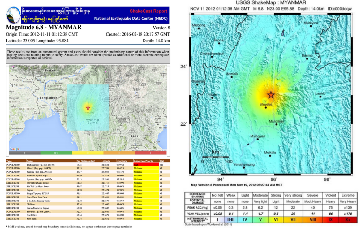
ShakeCast, short for Shakemap Broadcast, is an automated post-earthquake damage assessment tool, firstly developed by the U.S. Geological Survey (USGS). This freely available tool makes use of seismic data, minutes after earthquake origin time, to estimate risks to population and critical facilities.
RIMES customizes ShakeCast for estimating risks to population and critical facilities using real-/near real-time data from an earthquake event. ShakeCast uses exposure data at the smallest administrative unit e.g. village level population data and detailed building inventory and appropriate building vulnerability functions. Potential damage information is sent to registered users by SMS, fax, and email. Bulletins are updated based on improved earthquake parameters for the event.
Information generated by ShakeCast is useful for emergency first responders, loss estimators, and policymakers. Large organizations and/or government agencies can use ShakeCast information to automatically notify their maintenance units and/or rescue teams, based on shaking thresholds set for their critical facilities. Linked to GIS databases, impact on particular facilities could be quickly assessed, and timely information could be provided to ensure safety and efficient response.
ShakeCast Components and Functionality
1. Earthquake Hazard Evaluation and Potential Damage
ShakeCast uses ShakeMap, a model based on ground motion prediction equations (GMPEs), fault location for larger events, site condition maps (usually Vs30), and interpolation between strong motion data and estimates for measuring ground motion, e.g. intensity, peak ground acceleration, peak ground velocity or spectral response after an earthquake event. The system then compares the hazard, e.g. areas with low, moderate, or severe shaking, with vulnerable elements in an area to estimate potential damage to each element, and disseminates advisory for those estimated to have significant potential impact.
2. Customization of ShakeCast system
RIMES customizes ShakeCast system using country-based information, depending on available data and user specifications from member states. However, for countries that lack good building inventory database, open source application like Google Earth may be used to collect building information, e.g. building name, usage and location.
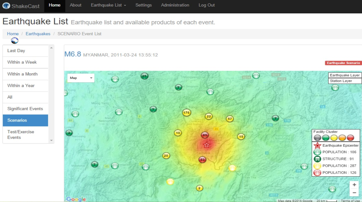
3. ShakeCast products
Information products from ShakeCast include notifications, potential impact bulletins on population and structures, and a summary report, disseminated via email or SMS. Generation and dissemination of these products are triggered for earthquake events at certain user-specified magnitude.